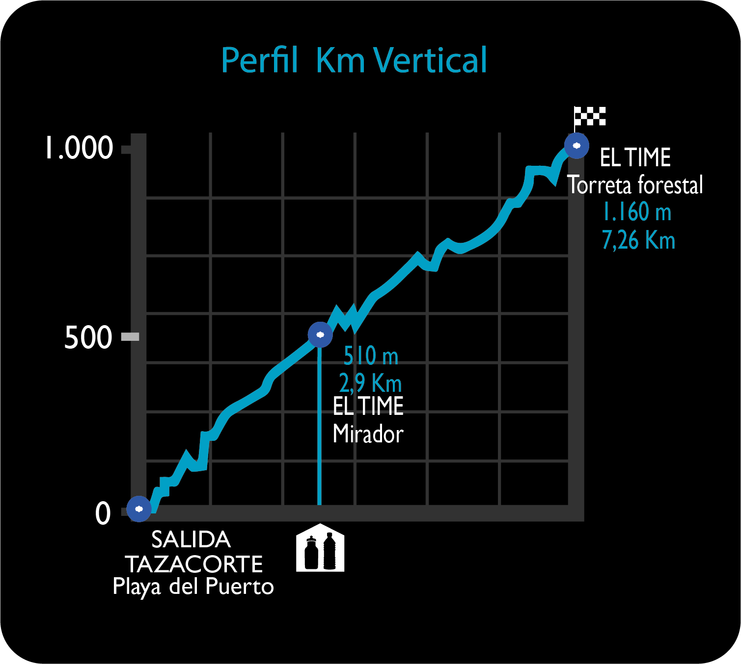
Start: Puerto de Tazacorte. Finish: Torre de El Time (Tijarafe). Race start time: 05:00 PM.
The Vertical Kilometer starts at Puerto de Tazacorte Beach (o m.), and continues through the emblematic GR-131, in the opposite direction of UltraTrail’s course. On this stretch, the path ascends the cliff face of El Time until the township of Tijarafe, in the old BananasWarehouse (273 m.).There you will enjoy a wonderful panoramic view of Tazacorte and its coastline.Then, the route continues its ascent alternating path and road until reaching the View Point Restaurant El Time (513 m.).
The climb follows the GR-131 track, up to the emblematic Hungarian House (624 m).At this point,we leave the GR-131 track and get into a local trail, in the township of Tijarafe. The TV antenna (722 m.) and the emblematic Viewpoint of Piedra del Guanche (750 m.) will be witnesses of the runners passing by.
The trail continues its ascent and connects again with the GR-131 (1,000 m) to finally reach the El Time forest tower (1,600 m) in Tijarafe. This route is 7.28 kilometers long with an elevation gain of 1,164 meters and an elevation loss of 102 meters, where runners will be rewarded with breathtaking views of the northeast side of the island and the Aridane Valley.