43,20 KMS
Start: Refugio de El Pilar
Finish: Puerto de Tazacorte
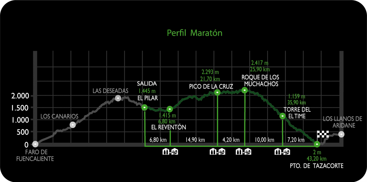
The route starts in the Recreational Area of ‘Refugio de El Pilar’ (El Paso) at an altitude of 1,450 metres, and continues along the GR 131 – Ruta del Bastón long distance footpath, until it reaches the Puerto de Tazacorte where the race finishes at sea level, next to the beach.
With a total distance of 43,20 km and 1,884 metres of accumulated positive difference in altitude and 3,329 metres of accumulated negative difference in altitude, this type of race requires a special physical condition because the final part of the route descends from the highest point of the island, Roque de Los Muchachos (2,426 m.a.s.l.) to sea level (Puerto de Tazacorte beach), so participants should take this into account in their previous training programmes.
- Profile
- Kilometric points
- Compulsory equipment


