73,06 KMS
Start: Fuencaliente Lighthouse (6:00 AM).
Finish: Los Llanos de Aridane.
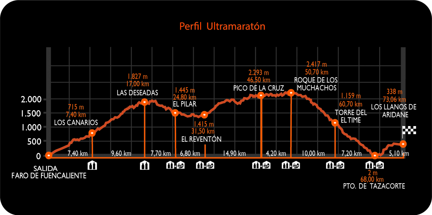
The Transvulcania running race. The route starts at the Faro de Fuencaliente lighthouse and continues along the “Gran Recorrido” trail GR 131, also known as ‘Ruta del Bastón’, to Puerto de Tazacorte. From there, it connects with the GR 130, Camino Real de la Costa, to the finish line, located in the Plaza de España – Los Llanos de Aridane.
Transvulcania is undoubtedly one of the toughest trail running races in the world, with a distance of 73.06 kilometres and 4,350 metres of cumulative positive altitude gain and 4,057 metres of cumulative negative altitude gain. From the starting line, located at sea level, the course climbs up to Roque de los Muchachos (2421 m.), the highest point of the island, then descends to Tazacorte and ends in Los Llanos de Aridane where the finish line is surrounded by an incredible atmosphere with lots of people.
- Profile
- Kilometric points
- Compulsory equipment


